Let's Map!
I’ve got a new toy, and a new hobby. The toy is a Garmin Venture Cx GPS, and the hobby is using it to make maps, as part of the Open Street Map project - free maps under a Creative Commons license. My flatmate Dave has also bought a GPS, and together we’ve been wandering and cycling around Putney, gathering tracklogs to make the map.
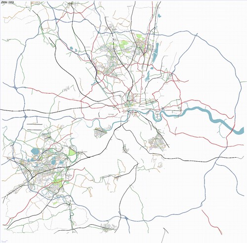
On the map above, we lay claim for the bit around Putney only so far- click on the picture to see which bit is ours. We’ve been doing it comprehensively, rather than just riding around randomly, which makes the maps look really good - I’ll post a closeup of Putney sometime. One of the trickiest bits is when someone watches me cycle down an obvious dead-end, all the way to the end, and cycle back up, while Dave takes a photo of the streetsign - the way they look at you makes you feel what we’re doing is illegal! I haven’t (yet) explained to any bystanders what we’re up to, but I don’t think it would help much anyway. It’s just a pity that everyone, everywhere is so hostile to passers by…
As you can see from the map, there’s a way to go yet, so this will probably keep me occupied for a few millennia! Let me know if you want to help out - next up is Richmond Park, Wimbledon Common, and probably around Barnes too.
This post was posted on 19 October 2006 and tagged Life, OpenStreetMap