Hill-shading on OpenCycleMap.org
It was over 18 months ago that I was originally trying to get hill-shading and hill-colouring working on OpenCycleMap (in fact, it wasn’t even called that back then, but that’s a different story). I eventually dropped the hill-shading part of it due to nasty boundary artefacts between source tiles, and due to the fact that the shading, well, didn’t look as nice as I wanted. It was all a bit grey and manky.
So instead I launched just the hill-colouring in August 2008, which I was very happy with, and put hill-shading on the back burner. Time passed. Much time.
A few weeks ago, I rolled up my sleeves and got stuck in to figuring out how to do the hillshading properly. With some pointers from Matt, Mike and the OSM Wiki, I played around for a few days until I liked the end result.
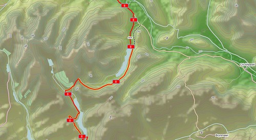
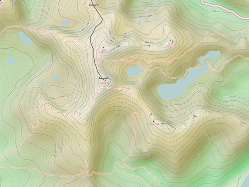
Here’s a look at Snowdon before hill-shading. The colours do a good job of showing the lie of the land, but it’s a bit flat:
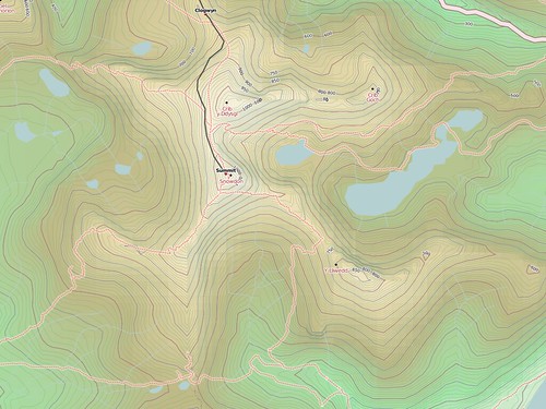
Detail:
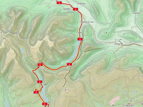
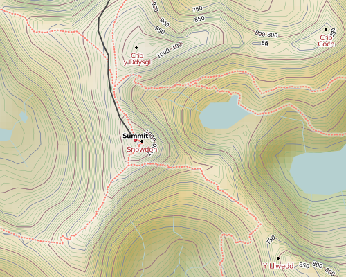
And what Snowdon looks like now. The shading lifts the peaks out from the map, and gives them a more solid-object feel:
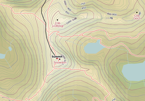
Detail:
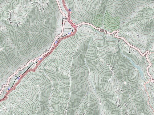
It really helps most in complex mountains, like here in the Alps, where the contours would otherwise become a jumble and it’s hard to tell valleys from ridges. With the shading, it’s easy.
It’s a hard balancing act, since OpenCycleMap is first and foremost a map for cyclists, and too much hill-shading overpowers and distracts from the rest of the map. But then again, too little and it doesn’t seem worth the effort! I went for a subtle approach, where it’s enough to make the hills stand out but little enough you might not consciously notice. Unfortunately the effect is diminished in forested areas, and by dense contours, since it’s only the background height colouring that is shaded and those things start obscuring stuff.
Also, I was never really happy with the “drab grey” approach to shading - just making the shadows grey and the highlights white using alpha-blending - so I settled in the end for “hardlight” compositing. It’s a bit like the evolution of GUI buttons from Windows 3.11 (“right, top and left edges are white, other two edges are black, grey in the middle”) with those from MacOSX (“ooh, shiny”). Compare OpenCycleMap to Google Terrain and other hill-shaded maps, and I’m quite proud of the results.
If you have a map project that could do with some good-looking terrain info, then I’m available for freelance work.
This post was posted on 5 January 2010 and tagged OpenStreetMap