Posts
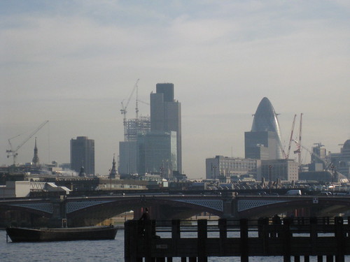
Heron Tower
I like how this giant skyscraper - going to be taller than the adjacent Tower 42, and taller even than One Canada Square in Canary Wharf, is slowly inching its way skywards. I wonder whether people will only really notice it when it becomes higher than Tower 42?
But it won't be the tallest for long, there's even taller buildings in central London on the way.
This post was posted on 29 October 2009 and tagged Photography, Society
From the Archives
Recently I got hold of the original video files from the OpenStreetMap State of the Map 2008 conference. Now I realise that the 2009 conference has been and gone in the meantime, but I think there's still value in the old videos - whilst a year is a long time in the land of OSM the more things change the more they stay the same.
As for me, here's a 20 minute video of me talking about the cycle map (it wasn't called OpenCycleMap back then) as it was around its first birthday. This was the first conference I'd ever spoken at, and aside from making some images before I left home the entire thing was put together during the conference (some things never change...)
Andy Allan: "OSM Cycle Map" at SOTM08 from Andy Allan on Vimeo.
I've already encoded all the remaining videos - you can see the full list on the OSM wiki. I'll be uploading the rest of them over the next few weeks, and probably pulling out a few of my favourites to share with you.
Apart from that, I have two more video editing projects up my sleeve. Now where did I leave all that spare time?
This post was posted on 1 October 2009 and tagged OpenStreetMap
Walking Papers
When I got back from a long weekend yesterday I came across a new project from the legendary Michal Migurski - “Walking Papers”. The basic premise is that when doing OpenStreetMap (especially in partially mapped areas) we all spend a lot of time scribbling on print-outs of maps. For example see one created by Dave that I’ve blogged about before.
So wouldn’t it be great if you could then trace over the printout to enter the data into OSM? This is where Mike’s site comes in. If you print out your map from his site, it comes along with special pictures in the corners that embed some information about orientation and position. So when you scan it in an upload it to the site, it automatically knows where in the world that scan corresponds to and skews your scan to fit properly. And then you can simply trace over your notes with Potlatch to enter your data. More technical details are available from his weblog.
Even if you don’t want to scan back in, it’s actually a good interface for just printing maps for annotation. The only improvement I’d make to the site would be using OAuth to log into OpenStreetMap (so you don’t give walking-papers your password), but since that’s not implemented just yet on OpenStreetMap.org I can hardly blame Mike! I’ll be very interested to see how many people use the service - you can see what I did when testing it out or simply get started yourself!
This post was posted on 10 June 2009 and tagged OpenStreetMap
Interlude
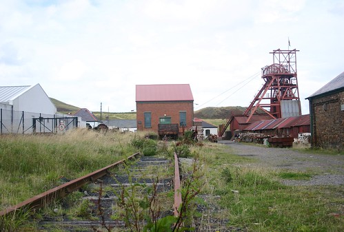
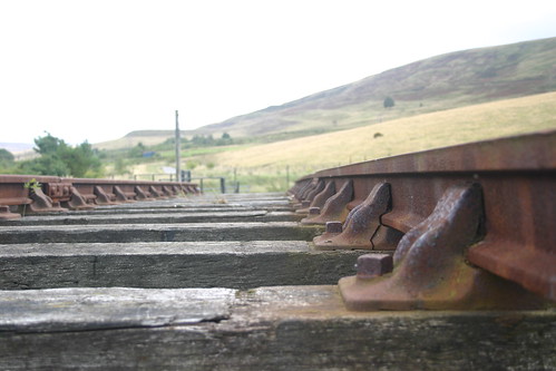
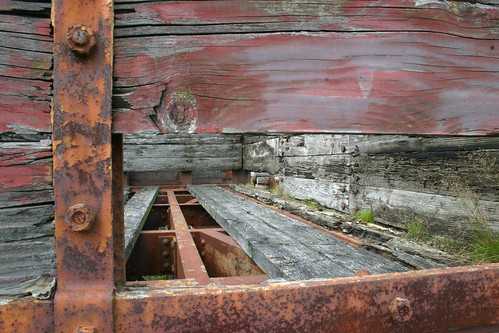
Some photos I took a while ago.
This post was posted on 30 April 2009 and tagged Photography
Interviews and Awards
Interested in my prognostications on the world's best cycle map or OpenStreetMap in general? Then check out the recent interview I had with Ed Freyfogle from Nestoria. And while you're over there, check out Nestoria itself or even better their experimental OpenStreetMap version of Nestoria.
September 2008 was a pretty busy time for me, including speaking at the Society of Cartographer's Annual conference (slides are online, although of dubious merit without the narration), and running a session on OpenStreetMap at FOSS4G in Cape Town. In amongst all that, I was interviewed by Peter Eich, but thankfully he was happy for me to stick to English!
It was also the month that I received two awards for my work on OpenCycleMap - the first, a Commendation from the British Cartographic Society (coverage over on the CloudMade blog), and additionally the prestigious "Lolcat of awesomeness" from OSM itself - technically I got a part share of the API0.6 award too, but who's counting?
This post was posted on 5 January 2009 and tagged OpenStreetMap
GMDLondon
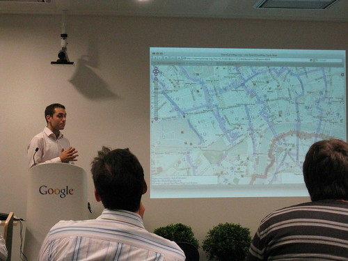
Last night I went to the first meeting of the unwieldy-named London Geo/Mobile Developers Meetup Group, which was hosted by Google at their London HQ. The three talks are nicely summarised by Gary Gale in his blog post on the event, but I just wanted to include something I always like to see - giant slides showing the cycle map:
Nice. But as Mike mentions in the comments on that photo, there's still a lot of people need awakening to the powers of OpenStreetMap. BikeRadar mentions a campaign to try to persuade Google to add bike routes to their maps (can't think who "burlyc" might be...) - there's now 43,000 people signed the petition, when they could already have mapped all the bike paths onto OpenStreetMap instead. Really, as Nick discussed last night in his "Five things you can't do with online maps" talk, the ideas behind everyone sharing the same, standard, (frequently Google) map are becoming long in the tooth - all the interest and an increasing amount of "cool" stuff is coming from the open-source/crowd-sourced/OpenStreetMap world. We just need to keep spreading the word and getting more people involved.
This post was posted on 28 November 2008 and tagged OpenStreetMap
Replacement Garmin eTrex Bike Clip
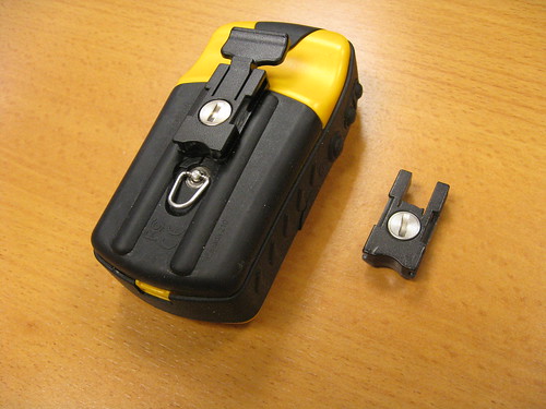
After some, umm, over-enthusiastic pinging by a volunteer at a recent OSM Mapping Party, the springy catch on my GPS's bike clip snapped off. In an attempt to get it fixed I left my brain out of gear and bought a second bike-mount kit from Amazon, but for reasons that still escape me only the handlebar-bit works with the 'x' models - in the kit there's a replacement back for units without the SD card that have the springy-bit molded on but that doesn't fit most models. So thinking back, I realised the removable clip I wanted had come in the original box, and as much as I fancy a new Legend HCx, I'm not paying hundreds of pounds just because of a two-pence piece of plastic broke!
But, good and surprising news came when I found a forum post that suggested phoning Garmin. Absolutely no hassle, they just sent me one in the post, for free. The cynical would say "just as well, it's their design flaw" but I just think it's nice when you stumble across some nice customer service - it makes a change. So if you're having the same problem (i.e. looking for a replacement 145-00709-00), just give them a call. And a tip of the hat goes to Amazon as well for their returns policy - even refunding the postage. Nice.
This post was posted on 21 November 2008 and tagged OpenStreetMap
8 Minutes to Addressing
Last week I was watching a(nother) emergency-services documentary, "8 minutes to disaster", charting the trials and tribulations of an ambulance crew around Reading. The titular time-frame refers to the central mandated target (grumble government bureaucracy grumble) of how long the crews have between receiving a top-priority call and getting to the scene of the incident. In amongst much of the usual diabolical behaviour of drunken idiots in proximity to the NHS, there was one scene in particular that struck me. Mainly because I see most things through an OpenStreetMap filter nowadays, but...
The ambulance crew were responding to one such high-priority call, to respond to house 54 on a street of which I can't remember the name. They had been told it had a brown door, and when they found house 53 with the other half of the semi having a brown door, they jumped out and started pounding on it. A few seconds later a neighbour helpfully pointed out that it was an unmarked "53a", so they jumped in the ambulance, and set off again. Finding house 54 further down the street, they again jumped out, but the wrong colour on the door gave the first indication they were now on the wrong street, so jumping back in the ambulance and taking the other fork in the road got them to the correct house 54, with a brown door, and when they finally got to the patient, he was dead.
Now admittedly the patient in question had been dead for a few days, so 3 minutes of faffing around didn't cause him any significant ill effects, but when the first scene of the program was a man quite literally bleeding out, it shows such things can make all the difference. And I was surprised that the crew didn't have some massively overcomplicated, Accenture-procured multi-million pound GPS system that had house numbers built in. Actually, now I think about it, it's probably best they didn't - having been involved in the periphery of a few NHS IT projects, I can say they are the best way yet conceived of turning gob-smackingly large amounts of taxpayers money into things that simply just don't work. So these paramedics are probably better off with a consumer device that other consumers have willingly chosen to pay for with their own hard-earned cash, rather than involving bureaucrats, even though it can't help them find particular houses in a timely manner. I've seen similar issues on other emergency-services documentaries - police getting stuck in housing estates due to barriers simply not on their commercial GPSes.
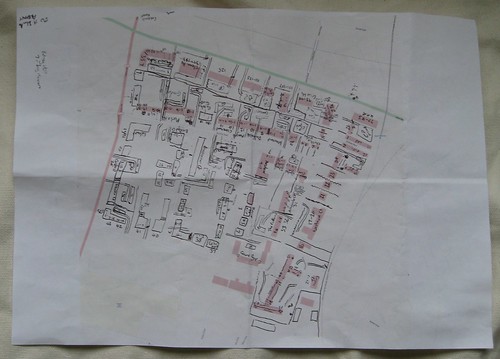
So the OpenStreetMap tie-in comes from having spent the last few weeks starting to look into what comes next for OpenStreetMap after we've mapped every road, pub and cycle route in the country (hey, what seemed wildly ambitious just two years ago is becoming increasing routinely anticipated), and what's technically known as "Addressing" is part of that. It involves taking things one step further than just knowing where each road is, and getting to the point where we know where each house on each road is. Now that's a whole lot of work, but in bits and pieces across Europe OSM volunteers are starting to try things out. Dave has made a start around our area - see his sketch above - which is made up of fiendishly complex blocks of flats and Matt has done some stuff near our office. Frederik and Jochen from GeoFabrik have even made a tool for helping spot mistakes in the data. There's a lot of potential here, but a lot of hard work, but with everything in OSM it's a case of when, not if.
So here's hoping that in the next year or two we'll see consumer devices working from the world's best global community-generated open-source mapping-cum-routing-come-addressing-cum-everything-else dataset, helping ambulance drivers (and pizza delivery guys, for that matter) from here to, well, everywhere. And maybe it'll be only a few years between us saying "OpenStreetMap is pretty accurate, but I wouldn't use it for routing ambulances" to saying "OpenStreetMap is pretty accurate, especially for routing ambulances". It'll be awesome.
This post was posted on 12 November 2008 and tagged OpenStreetMap, Transport
Busy Days
It’s busy days for me, as usual. Two weeks ago I was presenting and running a workshop at the Society of Cartographers Annual Summer School conference in Aberdeen. Flying back from that meant that I missed the awards ceremony for the British Cartographic Society’s annual awards - at which I was commended for the work on OpenCycleMap.org - there’s now a certificate hanging above the TV in our lounge, but I’ll see how long that one lasts. After all that, I spent a week on holiday in Wales - driving through some of the worst weather conditions I’ve experienced on the Friday after work. Most of the week was pretty soggy too, although there are plenty of paths in the area that need mapping. Interestingly (well, maybe only to me) we were in the area of the hill shading teaser that I made a few months ago - staying just off the top, and spending most days walking around there. As Richard said at the time, it’s a pretty nice area.
Whilst I’ve been back, I’ve been to the bar (once or twice), another mapping party, a Bourbon Blue band night, some climbing at the Westway, and was even interviewed by one of our German OSMers who came over to London. Next up, I’m off to FOSS4G in Cape Town tomorrow night for a week - now if only someone would come up with a more pleasant (and environmentally friendly) way to travel there… If you’re in Cape Town and fancy meeting up - give me a shout!
This post was posted on 25 September 2008 and tagged Life
Hill Colouring on the Cycle Map
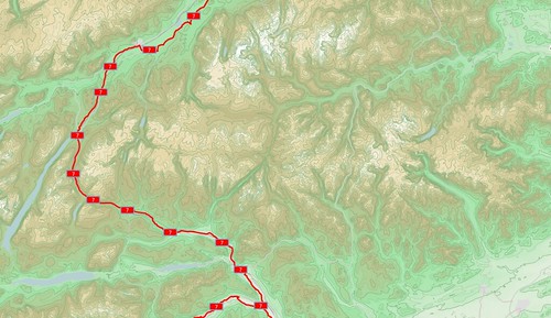
Last week, in amongst a bit of a hosting problem, hill colouring went live on the cycle map. And it looks awesome!
Having something more pleasing than a flat grey background really helps put flesh on the skeleton of the contour lines, but it means that some stuff needs tweaking to fit. You can see the lovely new forest and wood styles on the image below - my very own forest pattern symbol, with a subtle green tinge and a solid border. The same area before can be found (here).
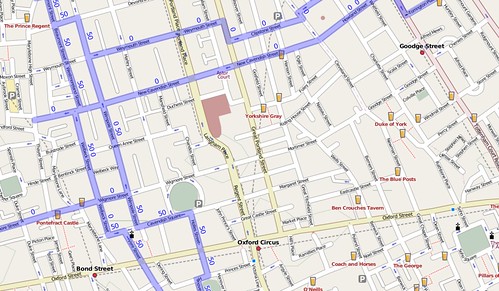
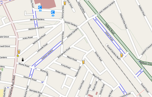
But wait - there’s more! In city centres, cycle routes can get quite complicated, and in some places have to go down one-way roads. You then end up with links that are only supposed to be followed in one direction - if you go the other way you might end up facing a no-entry sign (that you’re not really supposed to blithely ignore, politicians too for that matter). So you might end up with a confusing array of cycle routes, such as in central London:
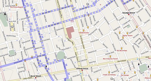
… but no longer. The swiss-army-knife-like ‘relations’ to the rescue, which can give pointers as to which way you’re supposed to go. That gives us …
(Click the pictures for more detailed loveliness!)
But wait, that’s not all. Maybe your area doesn’t have any signed cycle routes and no cycle paths either. Or maybe you’ve got both, and also want cycle lanes marked. A nice little bit of blue casing on either side of the road shows which streets have cycle lanes.
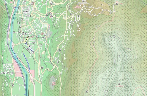
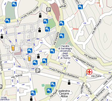
And finally, the icon wizardry of Matt Amos has helped me out with showing more useful points of interest - we now have drinking water locations shown (here in Trento, Italy):
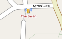
… which are probably a better idea than going to a pub. But what’s better than going to a pub for a nice refreshing beer? Well a pub with free wifi, of course!
And there’s been a million and one places added to the cycle map too, but far, far too many for me to list here. Enjoy!
This post was posted on 17 August 2008 and tagged OpenStreetMap
subscribe via RSS
