Posts
- Southern Wales - National Cycle routes winding through nice and crinkly landscapes
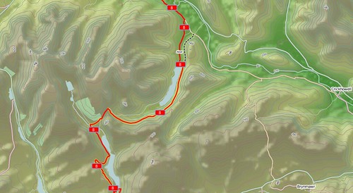
- Mountain biking trails near Machynlleth
- Alpine routes near Bern, Switzerland
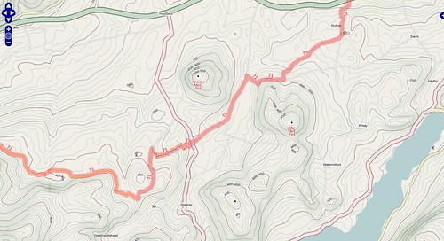
- Volcano spotting in the Philippines!
- Cycle shops. Evan's Cycles in Wandsworth is where I've spent more money than sense over the last year, so it now gets pride of place and a special mention here. There's a total of 50 bike shops in the database now that shop = bicycle has been decided on.
- NCN Mileposts. For those who haven't seen them, there are mileposts scattered around the National Cycle Network. Gregory Williams has been mapping (and photographing them for a while now, and his efforts are rewarded by seeing all 83 of them on the cycle map. Each of the four types has its own icon!
- Improved railways. Perhaps the most noticeable of the non-cycle updates, railways have had a major update thanks to the improvements on the main maps - tunnels are taken into consideration, for a start, but also more subtle greys instead of blacks. Areas like Camden look much better.
Look ma, no hands!
It's becoming more and more widely accepted within OpenStreetMap that what we call 'routes' are best described with relations, instead of tagging the ways. It means that we can have two routes sharing the same stretch of road without any conflicts over numbering and so on. It's become well established in cycle-tagging, but I'm interested to see if it works elsewhere in different contexts.
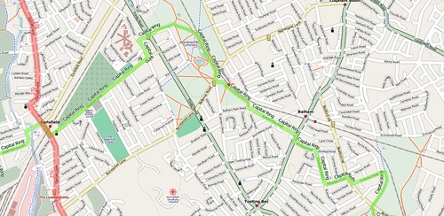
During the first May bank-holiday weekend Dave and I scratched an itch that had been bothering me for a while. There are a few long distance paths through London, and the two that I've frequently come across are the Capital Ring and the London Loop, but we'd made no effort to join up the bits we had spotted. We set off to find the route of the Capital Ring from Wimbledon Common to Wimbledon Park, and accidently ended up following it all the way to Woolwich on the other side of the city.
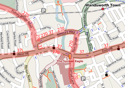
So combining both the relations contexts and the Capital Ring expedition led me to try to render them, to see if it works. And it pretty much does. Dave had been tagging some bus routes during the development of Potlatch's relations handling code so I rendered them too. And lo and behold, other people have been doing the same here and there.
London overview (click the picture, then the all sizes link to see it in full):
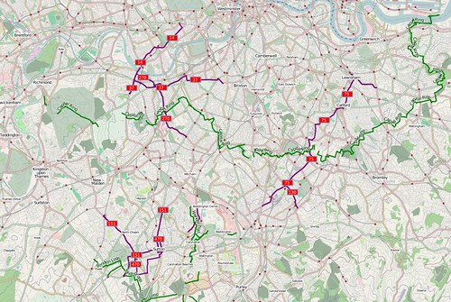
And the title of the post? Well, it's not only that I was practising my (currently abysmal) cycling skills, it's also what I say when I'm experimenting without having thought things through beforehand. No prizes for spotting which map I ripped off for the style sheets! Currently I don't have any plans for making this a full service like the cycle map, which is still my main focus.
This post was posted on 29 May 2008 and tagged OpenStreetMap
Hill Shade Teaser
Time for another glimpse behind the scenes in the Cycle Map development!
Elevation colouring! Hill Shading! How cool is that? (N.B. If you ever hear me asking, then the answer is one of 'very' and 'awesome'. 'Meh' is a valid response, but don't let me hear you saying it!)
Now for all the OSM types there's a few caveats. The last time I posted a teaser (for contours) it took me six months to get things working properly. And there's plenty of things need fixing before the hillshading will go live, like some resolution issues, tiling issues, a minor problem involving the ocean shapefiles and so on - never mind choosing some colours that are a bit more subtle. So be patient!
This post was posted on 21 May 2008 and tagged OpenStreetMap
Thunderbird doesn't notice new IMAP folders
So perhaps you have used a web-interface to create new subfolders on an IMAP server. The problem is that thunderbird doesn't show them, and no amount of clicking on things seems to solve the problem or show these subfolders.
The answer is to click on the account in question (i.e. one level up from your Inbox), then click "Manage Folder Subscriptions". From there on it should be obvious - find the folders, and tick the boxes. Job done.
This post was posted on 21 April 2008 and tagged Technology
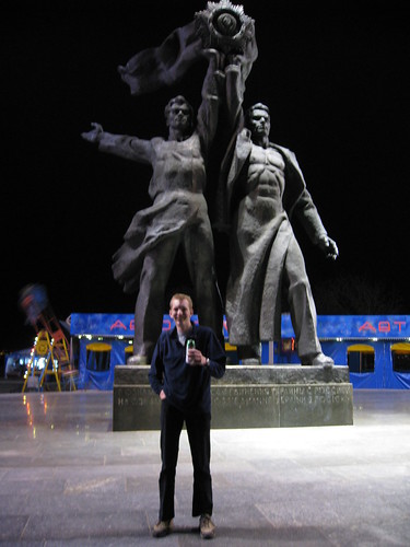
All hail the Motherland
It appears to be a popular pass-time to wander the streets of Kyiv, beer in hand, and admire the giant Soviet-era statues. Which suits me just fine.
Just look at those Russian abs. They knew how to make you, umm, feel impressed upon.
This post was posted on 15 April 2008 and tagged Travel
More cyclemap stuff
As usual, when the frequency of posts declines here, that just means there's more interesting things going on in the real world! I've also been trying to avoid writing yet another OSM post, but hey-ho, here's an update on the cycle map.
Lots more areas are now rendered since I blogged a month ago. Lyon, Vienna, Toronto, Vancouver, Antwerp, Almere, Neuss, Frankfurt, Furth, Karlsruhe, Berlin, Leuven, Bonn and Sydney have all been added along with overviews of some other countries. If there's somewhere else that you reckon could do with some more zoom levels, just leave a comment or send me an email.
Shelters are now rendered as can be seen in the forests near Bonn, and bike parking has been changed so that small capacity cycle stands show up as blue dots and only larger capacity bike parking areas show quite so predominantly! Previously, it could get quite cluttered as you can see when Tom Chance mapped the cycle parking around the parliament buildings in London. The changes were only partially implemented (or more accurately, I messed up some of the mapnik rules :-) ) so you'll need to wait a couple of days to see them working properly.
Also fixed was a UTF8 bug in the relations-handling code that meant that some recently-added routes weren't showing up properly at low zoom levels. We've also moved all the contours to the postgis database and stopped pre-rendering them - it turns out the IO hit of loading the transparent contour tiles from disk is greater than just re-rendering them for high zoom levels, and since most of the tiles are high zoom, that's where the time matters most.
This post was posted on 24 March 2008 and tagged OpenStreetMap
One Leg Longer than the Other
Contours are something that people have repeatedly asked me about - it’s even the closing subject on my radio interview a couple of weeks ago. This weekend I finally knuckled down and got to the bottom of a few outstanding problems (with thanks, as ever to Dave), and from today the cycle map takes a great leap forwards with world-wide contour coverage - well, “world-wide” as in everywhere that’s rendered on the cycle map.
Some of the highlights:
I’m really pleased with the way they’ve turned out, and I think this marks a step-change in functionality for cyclists planning their rides (or consoling themselves afterwards!). It does, however, take quite a lot of processing to generate these - it’s not for the faint-hearted or anyone without a quad-core machine overflowing with RAM and hard-disk space! The eagle-eyed amongst you may notice that all the roads have been tweaked and are more colourful now, but it’s still a cycling-focused map.
For those of you intrigued by the title - it comes from spending many years climbing up, down, and around mountains in Scotland - walking around the side of a mountain is known as “contouring” and gets pretty tiring after a while. Having adjustable legs would have been really helpful.
This post was posted on 18 February 2008 and tagged OpenStreetMap
The Bike Show
Last night's episode of "The Bike Show", aired on London's Resonance FM, featured an extended interview with your's truly on the subject of OpenStreetMap and my OSM cycle map. The interview was recorded out and about around London a couple of weeks ago - and if you want to listen to it, it's available on their website - "Reclaim the Street(maps)".
Also on the programme was a short interview with George Coulouris and Jean Dollimore from the Camden Cycle campaign. We've been collaborating over their mapping website, maps.camdencyclists.org.uk, to use my cycle maps as the backdrop to their routes, and you can switch from Google to OSM using the drop-down in the top right corner of their maps.
So those of you paying attention to the interview will know who finished off the LCN 22 a couple of weeks ago!
This post was posted on 5 February 2008 and tagged OpenStreetMap
Life on the bleeding edge
No, thankfully not a direct reference to my week of snowboarding, but the "bleeding edge" is a techie term for being so close to development that things go wrong as often as they go right. Which is more or less how the cycle map has been over the last fortnight.
Dave has bought new bits and pieces for the infamous "beerwarmer", the server that does all the work behind the cycle map, and written lots of clever code to take advantage of the quad core processor - to the point where 726,795 tiles takes only 1hr29m to render. But the biggest improvements have been in the mapnik rendering library, making great improvements to the text placement handling and semi-transparent layering options. I've no idea whether people will notice things like cycle shops and toucan crossings now showing above the route highlights (see Putney for example), or much better displaced-text (see Stockholm) but it's the little things that improve the quality, and with the recent work we've been doing with the mapnik developers there's now many more bits of polish that can be applied.
There's yet more areas added to the cycle map, including Trondheim in Norway and Bern in Switzerland. As ever, if there's anywhere else in the world that you want rendered, please let me know. I try to keep an eye on where national cycle routes are appearing, but I don't always notice all of them.
And my snowboarding trip didn't go unnoticed - a few worried people piped up on the mailing list to enquire what was going on with the lack of updates - no rest for the wicked!
This post was posted on 3 February 2008 and tagged OpenStreetMap
OSM Cycle Map on my GPS
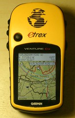
Sound familiar? Not quite. A year ago I posted about putting an OSM map of putney on my GPS. Six months ago I started doing the whole bike map thing, so now there’s significant amounts of cycle routes in the database - several thousand kilometres’ worth. And today, thanks to some work by Richard Fairhurst, I get to combine the two:
OpenStreetMap seriously kicks ass. I don’t know of anywhere else that you can get cycle-customised garmin maps, for free. Whenever anyone wonders why we bother with OpenStreetMap, HERE’S YOUR ANSWER. I’ll probably start distributing the gmapsupp.img files for anyone who’s interested. Thanks to Richard, Steve Radcliffe, Computerteddy and of course everyone who’s ever contributed cycle data to the project.
Oh, and it’s a serious pain in the ass trying to get good photos of a GPS - you should have seen the hassle I went through to get this looking better than the last one!
This post was posted on 13 January 2008 and tagged OpenStreetMap
Cycle Map - 6th December
Last weekend I finally got a chance to work on the rendering styles for the cycle map. The major work was to realign with the recent developments on the main OpenStreetMap style, as well as adding a few new cycle-specific features. Worthy of note:
For a while I'd been giving updates on new cycle routes being added, but that was back in the days when I could spot the weekly additions on a somewhat sparser map! Personally, this week I've added a stretch of the NCN 61 from Slough to Uxbridge, added more un-numbered London Cycle Network routes in Roehampton and West Putney and fixed up the NCN 22 through Wandsworth. The latter is interesting due to the appalling signing of the route - the "Wandle Trail" forms part of the NCN 22 and the LCN 24, and I think there's about one correct sign between Wandsworth and Carshalton - most of them mistakenly have "24" in the NCN signage! Dave bumped into someone from Sustrans who was going to be sorting this out, but I've no idea how far they've got since we cycled it a few months ago.
In related news, Cambridge Cycle Campaign have just published a City Centre cycle map using OpenStreetMap data. It's given me a few ideas for adding things to my cycle map - you compare this with the equivalent area of Cambridge.
I'll also be at the OSM Christmas Party tomorrow night!
This post was posted on 6 December 2007 and tagged OpenStreetMap
subscribe via RSS
