Tag Archives: OpenStreetMap
Cycle Map Quote
Richard Fairhurst, professional cartographer and one of the lead developers of OpenStreetMap, talks in his OSM diary about my cycle map:
Andy Allan's Mapnik map of the National Cycle Network is pure genius and the best example yet of why mashups suck, and cartography matters.
Now that's the kind of response I like to hear!
This post was posted on 4 August 2007 and tagged OpenStreetMapThe Skye Guide
It's probably about time I plugged a website that I like to keep an eye on - The Skye Guide. The eagle-eyed amongst you will notice what draws my interest... no, not specifically the creative commons license ( :-) ), but it's a website that my Dad runs in his spare time.
I've only been to Skye once, and that was many years ago, but I have to agree with the comment on the Quiraing - one of the most awesome places I've ever been. Don't miss it if you're nearby. I can't remember much else about my visit - other than a very, very talented busker in one village who we listened to ad-libbing about what was going on in the town in an amazing cross between folk guitar and observational comedy.
I'd love if he could link to openstreetmap instead of the ordance survey, but the coverage of Skye is somewhat lacking at the moment!
This post was posted on 31 July 2007 and tagged Intarweb, OpenStreetMapOpenStreetMap Cycle Map
So those of you who don't attentively follow the OpenStreetMap mailing lists will have missed my announcement of a new cycle map that I've made! It uses the National Cycle Network and local cycle network information that we have gathered to show a map specifically tuned for cyclists.
As you can see, it's not entirely complete, but we're getting there. The data for Putney is unsurprisingly quite good! From the talk on the mailing lists the map has spurred a few people to go back over areas where they know where the routes are, and add the right tags to make it show up. Spotting new cycle routes has turned into a hobby of mine now - it's amazing how many of them there are if you keep your eyes peeled for the little stickers on lampposts and the slightly more obvious street signs.
Even though we need to gather loads more routes, I already think this is one of the best cycle maps I've found online - much better than ones based on tracing over google maps. It's especially disappointing how poor the data is from Sustrans and the London Cycle Campaign themselves. Sustrans maps, if you use Internet Explorer and if their webserver isn't grindingly slow, can be found online, but it's fairly poor and you can't reuse it (or link to it). The London Cycle Network is ten times worse, with their online map requiring registration and their pdf maps are completely rubbish.
So not exactly competition for the end result, but they've got a head start on the data collection (well, they choose where the routes are, so that could be counted as cheating!). If anyone fancies inviting me to come for a cycle ride and map out a cycle route in their area, then let me know and I'll come and help. Other than that, sit back, and watch the weekly progress as the OpenStreetMap pixies come and map a cycle route near you!
This post was posted on 31 July 2007 and tagged OpenStreetMapFill the Gap!
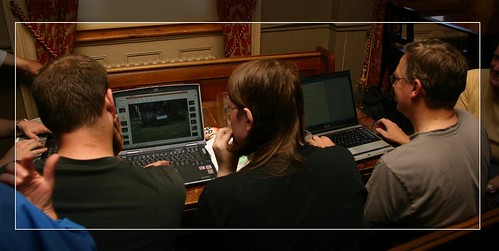
Last weekend was the "Fill the Gap" mapping party in Kew and Richmond - the gap being between all of our stuff around Putney and the stuff further south-west coming up towards Kingston. Although I had volunteered to help organise it, there wasn't much to be done after Etienne had found a venue. Having a pile of overhead imagery already printed out was worthwhile, since nobody brought their own!
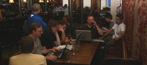
Photos of Streetsigns - sitting around in the pub working on the day's mapping generally attracts curious onlookers - people can never work out what we're up to!
This was after me, Dave and Mike had finished - hence the half-empty table!
On Saturday Mike made his first real foray into the world of OpenStreetMap, and he and Dave went mapping around Mortlake whilst I did the stuff further up the hill in Sheen. With the weather turning a bit miserable I volunteered to stay in the pub and mark up all the morning stuff (and lend a hand with other people), and when everyone was done we went for some pizza down at the river (courtesy of our sponsors; tastes twice as nice!). On Sunday morning Dave and I went round collecting a handful of missed bits from my Saturday zone, before I volunteered to have a quick blast around Richmond Park on my bike, hence saving Nick Whitelegg a few miles walk. Whilst I was there, I nipped out to fill in a couple more council estates that I'd got bored of doing on a previous expedition to darkest Roehampton.
One thing that surprised me in the pub - in amongst all the people with no idea what we were doing, one person remarked "Oh, OpenStreetMap? Yeah, I've heard of you guys". Interesting, and I wonder where from.
All in all, another good mapping party, and now the third that I've been on. At this rate though, there'll be not much left to map in a couple of years - and what will we all do then?
This post was posted on 21 June 2007 and tagged OpenStreetMap, PhotographyBiking and mapping
I seem to blink, and another month goes by.
Last weekend I went mountain biking in Wales with Gary, which was great fun. We stayed at the Cae Gwyn Farm B&B, which was very nice, and a short downhill ride to the mountain biking centre at Coed y Brenin. First time I’ve done proper mountain biking on rocky trails - it would have been impossible without suspension, and even with, it was pretty hard going. Still, I think I’ll be doing it again some time soon. Anyone else fancy it?
I’ve also been doing more openstreetmap stuff - there was an interesting mapping party at a eco-warrior type place down in Mitcham (the Pathways of Desire party I mentioned previously), looking to open up paths and cycle tracks through some wasteground nearby. A worthwhile pursuit, and I’m looking forward to the day when OSM starts producing customised maps for cyclists and suchlike. If you haven’t looked recently, the main map has had an update - check out how Putney is doing! It’s going from strength to strength. Needless to say, I was collecting tracks when biking with Gary, and I’m trying to find time to trace them out into the system…
This post was posted on 20 March 2007 and tagged Life, OpenStreetMapMapping parties
A fortnight ago was the OpenStreetMap London mapping party. It was the first mapping party I had been to - but it was on the weekend that my snowboarding trip finished, so I wasn’t sure how much of it I was going to make. As it turned out, I got there on the Saturday in time to join everyone in the pub - and after getting up late (and hungover) the following morning, we only had enough time to fill in some blanks along either side of Oxford Street. Dave (in green, second from right) had done more during the day on Saturday.
Mapping parties are weird, because whilst we’re all being sociable and working together on a project, when we’re actually out doing stuff, it goes back to a solitary pursuit. But getting to put names to faces in the pub is always worth it!
I’m not sure if I’m going to go to the Bristol event on the weekend after next, but I’m interested in the “Pathways of Desire” party next month - it sounds a bit different from the urban mapping I normally do, without being inconveniently far away from London!
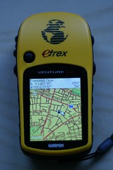
Oh, and the picture of Putney on my GPS is currently the Featured Image on the front page of the OSM wiki, as well as having been favourited by someone on flickr - both of which I’m quite proud of!
This post was posted on 13 February 2007 and tagged OpenStreetMapOSM on my GPS
The picture says it all, or rather says most of it at least. I’ve bought a microSD memory card for my GPS, and now it can take extra maps on it. And of course, what map would I want on it, other than OpenStreetMap? Dave and I have spent ages cycling round, doing our local area, and now I get to put the results on my GPS and make up for the terrible basemap that comes with it.
For the technical amongst you, I used JOSM to download and save a .osm of the local area, and then converted that into a Garmin .img file using mkgmap. I can then transfer it to the microSD card using a card reader (thereby avoiding the non-opensource cGPSMapper and sendmap, which doesn’t work on linux for my GPS anyway). It’s interesting that the area bounded by Richmond (W), Hammersmith (N), Clapham (E) and Wimbledon (S) takes up 35K, and my 1Gb card cost £25. There plenty of room for more where that came from.
Ant, can I interest you in the .img file?
This post was posted on 7 January 2007 and tagged Life, OpenStreetMap, PhotographyLet's Map!
I’ve got a new toy, and a new hobby. The toy is a Garmin Venture Cx GPS, and the hobby is using it to make maps, as part of the Open Street Map project - free maps under a Creative Commons license. My flatmate Dave has also bought a GPS, and together we’ve been wandering and cycling around Putney, gathering tracklogs to make the map.
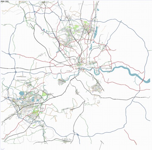
On the map above, we lay claim for the bit around Putney only so far- click on the picture to see which bit is ours. We’ve been doing it comprehensively, rather than just riding around randomly, which makes the maps look really good - I’ll post a closeup of Putney sometime. One of the trickiest bits is when someone watches me cycle down an obvious dead-end, all the way to the end, and cycle back up, while Dave takes a photo of the streetsign - the way they look at you makes you feel what we’re doing is illegal! I haven’t (yet) explained to any bystanders what we’re up to, but I don’t think it would help much anyway. It’s just a pity that everyone, everywhere is so hostile to passers by…
As you can see from the map, there’s a way to go yet, so this will probably keep me occupied for a few millennia! Let me know if you want to help out - next up is Richmond Park, Wimbledon Common, and probably around Barnes too.
This post was posted on 19 October 2006 and tagged Life, OpenStreetMapsubscribe via RSS


